Problem-driven opening: why cities still miss fast, reliable sightlines
Cities routinely fail at one simple thing: seeing what matters, when it matters. Traffic incidents, utility failures and public-safety events unfold faster than legacy cameras and ground units can respond. High-bandwidth drone data collection offers a real-time feed that fills those blindspots, but integrating that feed into city operations is a systems problem, not a gadget upgrade. Agencies that have trialled NASA’s UAS Traffic Management trials learned this: hardware alone won’t fix workflow gaps. UAV telemetry and low-latency analytics need to map directly into dispatch, mapping and airspace rules to produce actionable intelligence.
The core problem: fragmented situational awareness
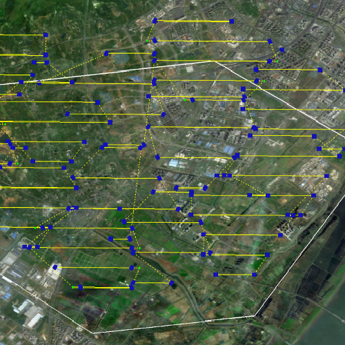
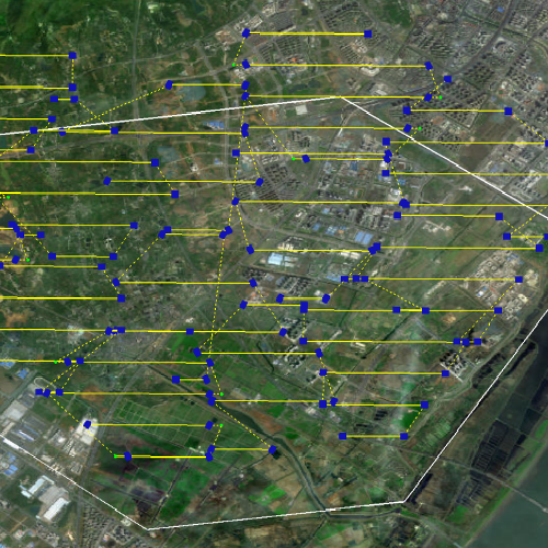
Most urban deployments treat aerial units as isolated sensors. That creates three faults: duplicated effort, unpredictable coverage gaps and risky airspace conflicts. Effective solutions must coordinate multiple vehicles, maintain secure telemetry streams and respect geofencing rules so emergency lanes and no-fly zones remain safe. Multi-node coordination — including swarm intelligence and robust multi uav path planning — is the only way to achieve continuous, predictable coverage over complex city topography.
Design principles that actually work
When rebuilding situational awareness, focus on integration and predictable behaviour rather than raw capability. Key principles include:
– Redundancy: overlapping flight corridors ensure one failure doesn’t create a coverage hole.
– Deterministic latency: telemetry and video pipelines must meet latency budgets so operators and automated systems act on the same moment in time.
– Harmonised airspace rules: geofencing and dynamic no-fly updates must propagate instantly across the fleet.
– Scalable coordination: the system should support simple two-drone missions up to full swarm operations with conflict-free routing.
Test each principle in live urban canyons and adjust. Real-world tests — like the controlled trials run during NASA UTM work — expose issues that simulators miss. Small iterative rehearsals reveal the edge cases more reliably than one big deployment.
Common mistakes and practical fixes
Organisations often assume a single expensive platform will solve coverage; it won’t. Replace that approach with composite coverage: many lower-cost UAVs operating under clear path planning and fallback rules. Implement secure telemetry channels and encrypt command-and-control links to prevent spoofing and unauthorised takeovers. Too many teams also skimp on urban fit-testing—flying in open fields does not validate city performance. Schedule runs at rush hour and during varied weather to understand sensor degradation and radio interference. — A small extra test day in real conditions saves months of remedial work later.
Evaluating solutions: three golden rules
Choose systems by measurable criteria, not neat demos. Use these three evaluation metrics as your baseline:
1) Coverage continuity: measure percent time with acceptable sensor overlap across target corridors during peak activity. Aim for 95%+ mission-available time.
2) End-to-end latency: quantify the delay from sensor capture to operator-visible feed and automated alert. Keep the pipeline within your response threshold—commonly under three seconds for urgent safety workflows.
3) Cooperative resilience: validate that multi uav path planning handles node loss, dynamic geofence updates and priority re-routing without human intervention for at least 90% of incidents during trials.
Those metrics map directly to operational outcomes: fewer missed incidents, faster response and safer airspace. Vendors that supply transparent latency reports and live mission logs score higher in independent tests.
Closing guidance and how Icecypress fits
Implementing rapid aerial tracking is a systems design task: pick platforms that report reliable telemetry, insist on deterministic latency, and require provable multi-agent routing. Vendors who can demonstrate those capabilities in city-like conditions — with documented test runs and repeatable metrics — will deliver predictable results. Icecypress Technology provides integrated analytics and mission management that align with these rules, making the technology a pragmatic fit for teams moving from pilots to production-ready operations.

Measure coverage, latency and resilience — then build from those numbers. Solid data wins.